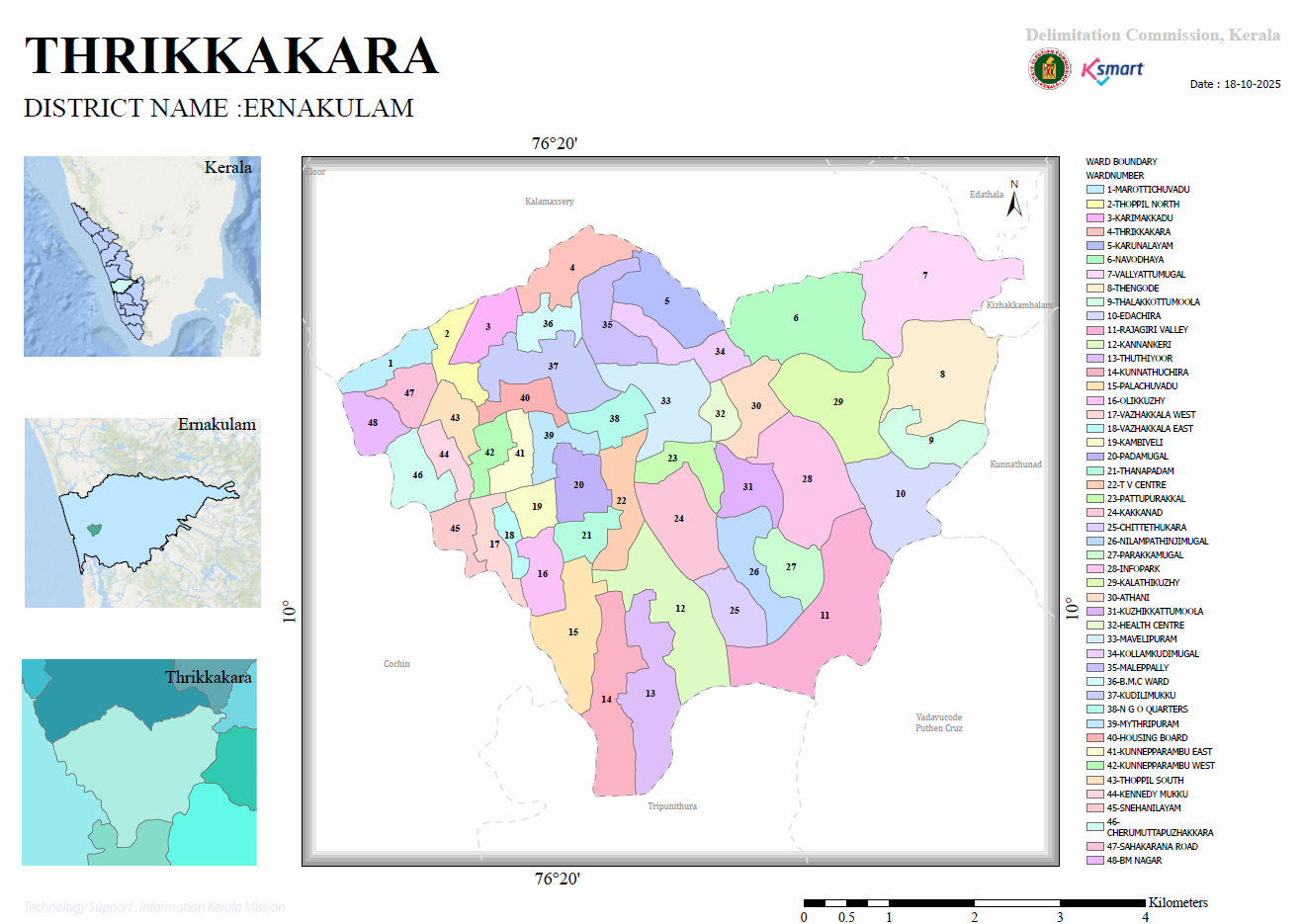
Thrikkakara Municipality is an urban local body within Ernakulam District and forms a major part of the eastern metropolitan region of Kochi. The municipality is divided into 48 wards, each represented by a defined administrative boundary. The map was prepared for delimitation purposes and reflects ward boundaries as of 18 October 2025.
Administrative Context
- District: Ernakulam
- Local Body: Thrikkakara Municipality
- Number of Wards: 48
- Map Date: 18-10-2025
- Purpose: Ward delimitation and administrative boundary representation.
Geographic Setting
The municipality is surrounded by several important local bodies:
- Kalamassery
- Edathala
- Tripunithura
- Vadavucode
- Puthencruz
- Kunnathunad
- Eloor
- Kizhakkambalam
- Kochi (shown as Cochin on the map)
This location places Thrikkakara strategically between Kochi's urban core and the rapidly developing suburban technology corridor.
Ward Structure
The municipality consists of 48 wards. Key wards include:
- Marottichuvadu
- Thoppil North
- Karimakkadu
- Thrikkakara
- Karunalayam
- Navodhaya
- Vallyattumugal
- Thengode
- Edachira
- Rajagiri Valley
- Kakkanad
- Infopark
- Athani
- Mavelipuram
- Housing Board
- NGO Quarters
- Mythripuram
- BM Nagar and others.
Urban Development Characteristics
The ward names reveal several functional zones:
Technology and IT Corridor
- Infopark Ward (28)
- Kakkanad Ward (24)
- Edachira Ward (10)
These areas represent the municipality's role as Kerala's major IT and knowledge economy hub.
Institutional and Educational Zones
- Rajagiri Valley
- Navodhaya
- Health Centre
- TV Centre
These indicate significant educational, healthcare, and public-service land uses.
Residential Growth Areas
- Housing Board
- NGO Quarters
- Mythripuram
- BM Nagar
- Sahakarana Road
These suggest planned residential development and urban expansion.
Planning Insights
The ward distribution indicates:
- Highly urbanized municipal character with dense residential and institutional development.
- Strong IT-sector influence around Kakkanad–Infopark.
- Mixed land use pattern, combining residential, commercial, educational, and administrative functions.
- Strategic metropolitan position connecting Kochi city with eastern suburban growth corridors.
- Administrative complexity, requiring 48 wards for local governance and service delivery.
Conclusion
Thrikkakara Municipality has evolved from a traditionally agrarian settlement into one of Kerala's most significant urban municipalities. The delimitation map highlights a diverse urban landscape centered on Kakkanad and Infopark, supported by educational institutions, residential neighborhoods, and civic infrastructure. The 48-ward structure reflects both its population density and its importance within the Kochi metropolitan region.